
 Location: Derbyshire Peak District
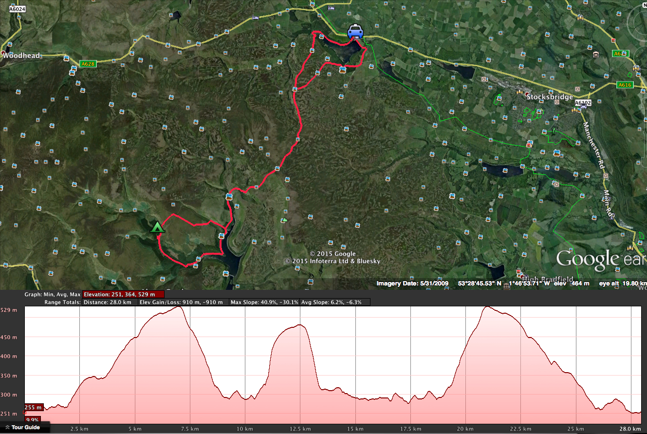
Distance: 19.3km
Date: November 2014
Kit: Tarp (MLD Trailstar)
Eighth Wild Camp testing out the new Alpkit Down jacket.
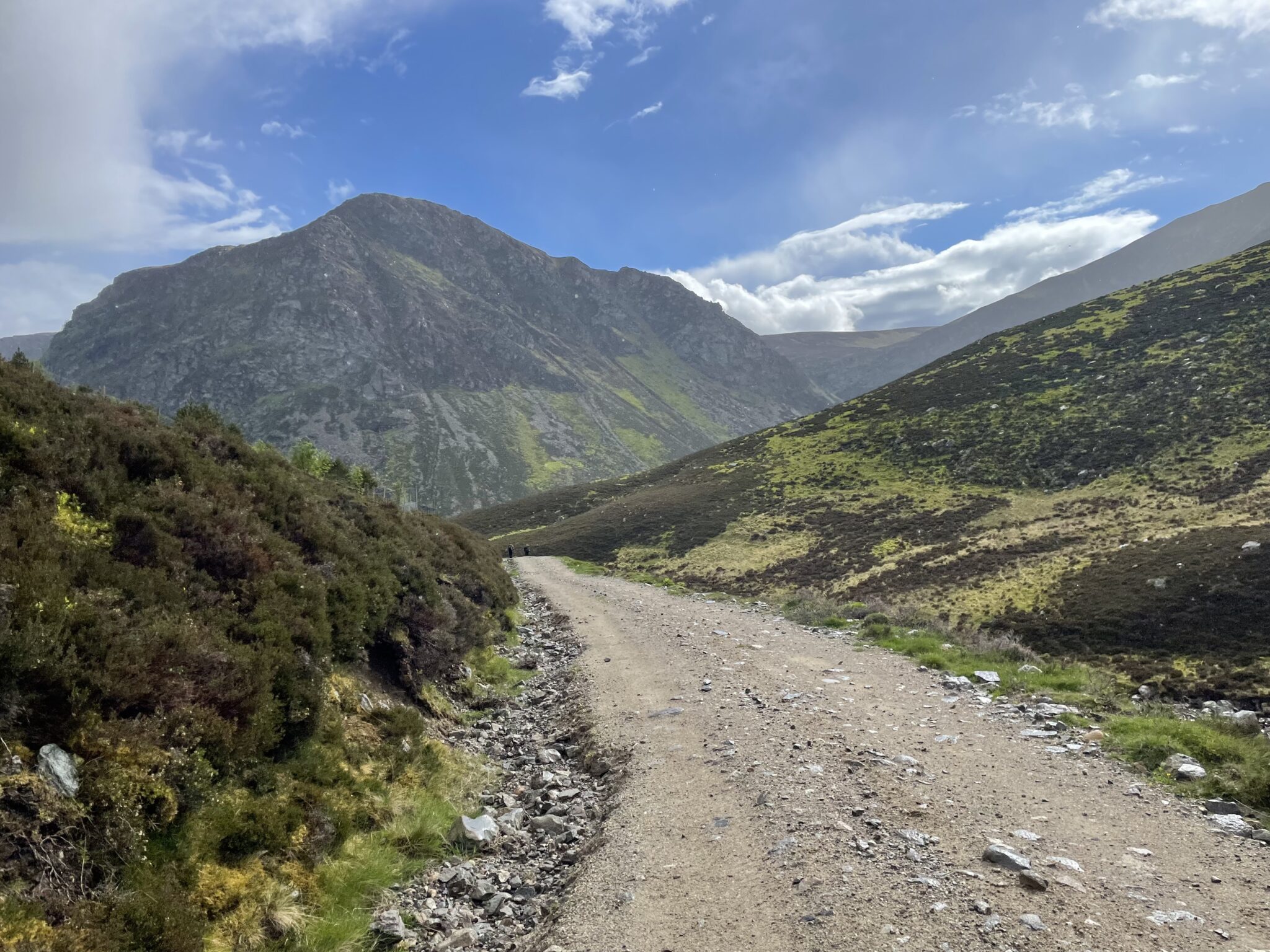
For sometime I’d been trying to plan a 24hr route that camped at the River Westend. Its a tricky place to get to without circling Howden and Derwent Reservoirs which include a number of very busy footpaths. The solution I found was to start at Langsett Reservoir and drop down to Margery Hill. The issue with this route is that its a “there and back”, not my favourite type of route. I tried a number of alternative routes such as taking one leg around to Bleaklow first to break it up, but it made the distance unachievable in winter (at my pace anyway). Accepting that the route had to be a there and back at this time of year we set out. The route started at the carpark in Langsett and follows the Cut Gate path south to Margery Hill. Although it did’t appear busy the path was very well trodden. Large sections of the path are flooded by nearby streams and deep peat bogs run alongside the path which get gradually larger and wetter as you reach Margery Hill. Passing the summit to the west the route drops down parallel to Bull Clough and into Cranberry Clough. Crossing the small beginnings of the Derwent River at Slippery Stones and following the Howden Reservoir for a short section. The route (simply for variation) then heads North West to Linch Clough and up a steep hill to Ridge Nether Moor. From the OS map and studying Google Earth we were looking for a long ditch/grouse butt which we eventually found and followed to Banktop Hey. Some fairly expert (lucky) night navigation brought us out at the River Westend. It was getting fairly dark at this point and we wanted to cross the river to setup camp on the other side. The only crossing seemed to be a ford where the water was about 12″ deep. We followed the bank for a short while to look for a better crossing without luck. Preparing to take off our boots and wade across we found a nice grassy area on our side of the river so opted for that. The usual night of wayfarers and wiskey followed. The night was cool but thanks to my new Alpkit Down jacket I was toasty warm. The next morning the route continued along the River Westend where we found a BRIDGE!! It was only 50yards further down stream, had it been marked on the map or if it was daylight when we reached the river the day before we would have found it. In hindsight we found the best camping spot anyway so in a way not finding the bridge worked out for the better. The route continued until it reached Howden Reservoir where we looped back up to Margery Hill and back to Langsett. Check out the Wild Camp Map page for the route and camping location.
A nice area with plenty of variation of rivers, reservoirs, moorland and woodland. The next time I visit this area I’ll look at a better route that perhaps includes Bleaklow or maybe Alport.
Lessons learnt:
1. Avoid there and back routes (if possible)
2. Navigating at night relies on an accurate map (and map reading)
3. Winter routes should be less then 20km per day (over similar terrain)
Pingback: Alport Dale Wild Camp - UK Wild Camping
Pingback: Alport Dale Wild Camp - UK Wild Camping